Day 61: Pinchot Pass
Date: June 29, 2017
Miles: 11.6 miles (18.7km), from mile 799.7 to mile 811.3.
Health: I'm completely drained and so tired. Bushwhacking through snow all day is so tiresome.
My alarm goes off at 4:50am but I don't want to wake up, I feel so beaten up. I peek through my door to see if the girls are up. No movement. I press the snooze button.
I keep snoozing until 5:30am when I hear the distinctive sound of air mattress being deflated. KB does this every morning. She opens the valve while she's still on the mattress and uses her body as a weight to deflate it. Time to start moving.

Crossing rivers with a bridge is a rare luxury.
It's not that cold outside but I don't want to get out of my sleeping bag. I finish all my other chores from within the warmth of the bag and only at the very end get out. We pack our packs and head over the suspension bridge one by one. It's both cool and strange that there's a bridge here. It's the first one we've seen and it takes us across a raging river so we're very thankful for having it here.

800 miles!
Right after the bridge there's an 800 mile marker. We spend few moments looking at it and then start our climb towards the Pinchot Pass. From here the trail climbs for the next 7.7 miles (12.4km) during which we climb from 8,546 feet to 12,107 feet. So we gain over 3,500 feet (1067m) of elevation.
Below 10,000 feet the trail is mostly clear of snow and just full of water. We cross smaller and medium size streams where water goes from ankle deep, up to the bottom of my shorts. Like yesterday, our shoes and socks are going to be wet all day.

Unmarked stream across the trail.
On the way up we pass the Woods Creek Waterslide but I'm the only one who stops to look at it. We hit few snow fields, which are still frozen and slippery after the night, and then get to a forest. After what seems like forever we get out of the forest and have our first break. We've hiked for over two hours but only covered 3.4 miles. Damn that's slow.
The Sierra is completely different beast compared to the desert. In the desert you walked on a trail all day long and the distance you covered during the day depended on how fast you were hiking, for how long, and how many breaks you took. But making big miles was generally easy. Here in the Sierra, especially now on a record snow year, miles are extremely hard to come by.
We hardly ever see the trail, as it's under the snow, and we have to navigate on our own. River and stream crossings are another thing. We might have to walk for miles up or downstream to find a suitable spot for crossing safely. None of these miles are included in our daily mileage as none of that walking is taking us forward on the PCT. It's just extra mileage we have to do to safely move forward in Sierra.
Climbing big snow banks, sliding and slipping around on snow, wading in ice cold water. All this is starting to take its toll on my body. I've had trouble sleeping well in the Sierra and I think all that is catching up to me. I can't keep up with the girls and every step hurts.
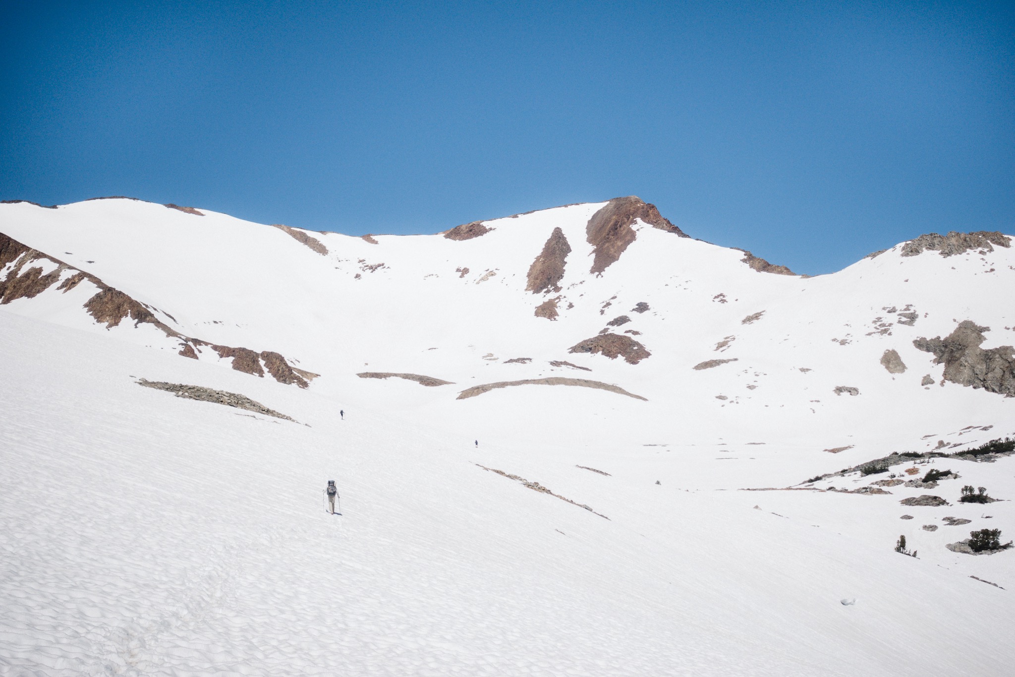
We meet up with Topo and DG and hit the snow with them. From here, it's still over three miles before we reach the pass. I have to go and take care of some hole digging and others slip away. Soon I'm standing on an endless field of snow and sun cups and they keep going for as far as the eye can see. I don't see the others, or their footprints on the snow. The snow is still too hard to leave any prints on.
I use the GPS to get a general direction and start slowly hopping over the sun cups. The sun cups form as the snow melts and forms small puddles on the surface snow. The water works as a magnifier and causes the snow under the water to melt faster. The cups can be up to waist deep. To move anywhere, you need to hop on the small bridges between the cups. The bridges are two to four finger wide. When you have to do this for miles and miles, it's really slow and tiresome.
I slip few times badly and fall into two large sun cups. I curse the snow and switch on my microspikes to get better traction. But it's only a minor help.

Looking back on the way up.
Soon I see couple hikers climbing a hill to my left and after double checking the GPS that it's the correct direction, I follow them. Climbing a steep hill covered in sun cups is just horrible. I feel like crying but it's of no use. I can't see anyone and there's nowhere else to go. I wish I had my regular energy and I could just power through these damn snow bowls.
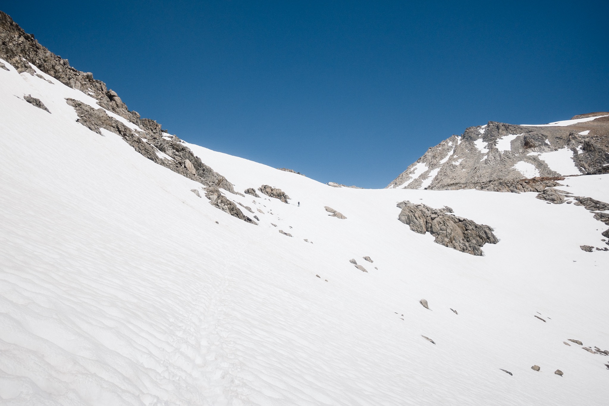
Once at the top of the sun cup hill, I see Topo, DG, and Tailor and the Swiss. From here we can see the pass far up ahead and above us. I see KB, Dandelion, and Fireant halfway up approaching the pass. I'm so tired that I have to sit down and take a break before pushing on.
Almost at the top.
Others head up and I sit on a rock in the hot sun. The heat feels so good. I set my alarm 20 minutes on and close my eyes. I fall asleep immediately.
When my alarm goes off, I see that the others are already one third of the way up. I get my things packed up and head after them. From here it's all uphill to the top of the pass.
I can see the pass far up ahead, and others hiking towards it. They look so small, surrounded by all these massive mountains. Like little black dots in a vast, far reaching snowfield.

Fireant and Dandy.
That little nap gave me some energy and before I notice it, I've gained the distance to the others and I'm only a little behind them. The climbing isn't too technical, but I'm still tired from moving uphill on snow. Once at the top I curse and moan and sit down behind a rock to take cover from the wind. It's time to eat to get more energy.
After the food everyone starts heading down on the other side. To get down, we first have to cross a field of rocks. After that, we get back on the snow. It looks like there's not much glissading today. I trail behind everyone and am the last to arrive on the next stop.

Resting at the top of the Pinchot Pass.
We break on a nice, warm rock and I need to eat more. It's good to eat as much as possible as it makes my pack lighter. The girls head out soon but I'm too tired to follow. I forget to tell them not to wait for me as I'm staying behind. I only remember this when they disappear from the view.

DG at the top.
I head down with DG, Topo, and Taylor and the Swiss. After more sun cups we reach a river we need to cross. We walk about 0.25 miles downstream and cross it from where it's wider. It gets only up to knee deep.

Climbing down from the pass.
I squeeze the water out of my socks as my toes are starting to get cold and then continue descending down to the valley. There's still snow and small streams everywhere. I fall badly on one steep snow bank and almost hit my head on my ice axe. Frigging snow!
Everyone spreads out in the steep forest and I'm soon alone with Topo going down a muddy hill. We reach the last river crossing of today with Topo and see the girls on the other side. At the same time we hear yelling from downstream and see Taylor and the Swiss crossing over a rather sketchy looking log. The girls signal us to go upstream.

After a little miscommunication, as we can't hear each other over the sound of the river, we figure the spot they are telling us to cross from and get into the water. The water hits my groin and I have to get back up as I forgot my phone in the pocket of my shorts. New try. The water rushes fast but it doesn't have any power to it so it's an easy crossing.
Little bit of dry trail.
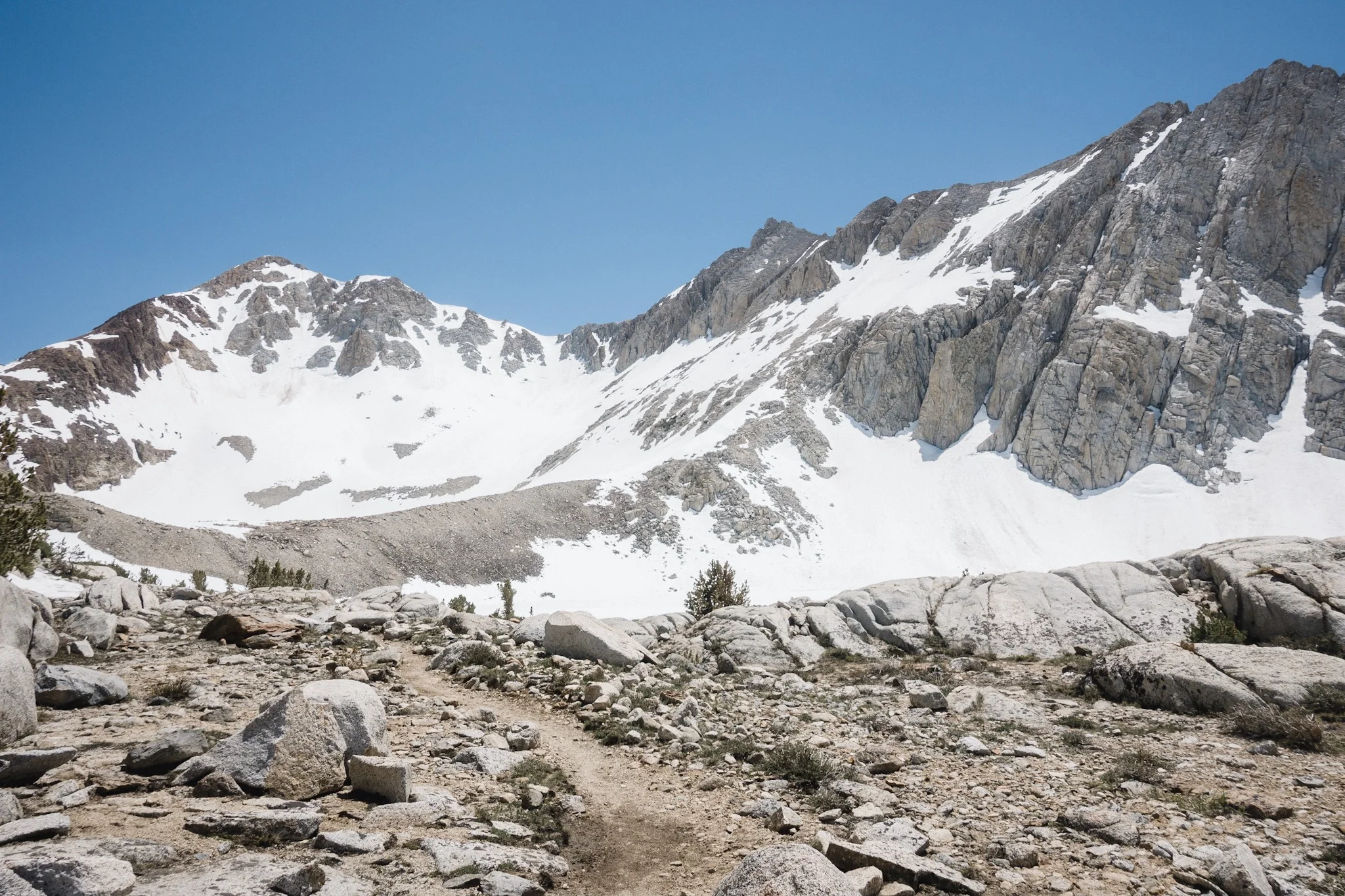
I set all my gear to dry on the hot rocks and thank the girls for the directions. They want to push for four more miles, up to the approach for the next pass. There's a huge, powerful river between the pass and us, and the best option is not to cross the river. This means bushwhacking upstream along the river side and crossing the smaller streams, tributaries, that connect to it.
I don't have enough energy to do that so I tell the girls that I'm staying on the campground just down from where we are. Not only am I tired, but the girls are trying to push 17 miles per day to make it to Mammoth for the 4th of July, the Independence Day. I don't want to rush through Sierra with such speed. Or get to Mammoth on the busiest weekend and pay outrageous prices for lodging.

I have enough food that I can go slower and enjoy my time in the most beautiful section of the whole trail. 17 miles per day would be a lot without any snow in Sierra. With all this snow it's too much for me at this point.
I tell the girls that I'll see them in Mammoth and wish them safe journey. We hug and make plans to meet up when I get to Mammoth. The girls hike on as I stay with Topo to dry my wet gear.

Mine and Topo's.
We wait for awhile and soon DG arrives. We show him where to cross and wonder why he's all wet. Once he's over the stream, he tells us he tried crossing from upstream and fell in the river. While in the water, he lost his microspikes. That's bad news as he's going to need them tomorrow for getting over Mather Pass, the steepest pass we'll encounter on the trail.
DG has had quite a day. He forgot his hiking pole to the campground in the morning, along with his breakfast. Then he fell into the river and lost his microspikes.

Taylor and The Swiss.
We setup camp with Taylor and the Swiss and make fire to dry our gear. I'm going to get to bed early tonight and sleep. Tomorrow we're going to tackle Mather Pass and few bad river crossings. As I go to bed, I hope I gain some energy during the night, or it's going to be a long day tomorrow.
Sponsored by:
![]()